How Smart City Tech and Open Data Can Help U.S. Mayors Uphold the Paris Climate Accord (Part 2)
This blog post is the second installment of the larger theme "How Smart City Tech and Open Data Can Help U.S. Mayors Uphold Paris Climate Accord". The article focuses on the transportation and water treatment sectors, and how open data and smart city technology can help.

In Part 1 of this series, we looked at the commitment cities have made to continue to uphold the Paris climate accord in the wake of the Trump Administration’s decision to withdraw from the agreement. We also presented case studies to demonstrate some actions cities have taken to achieve emission reductions from buildings using smart city technology and open data. In this installment, we do the same for the transportation and water treatment sectors. We also present some of the challenges initiatives like these face, including financing, security, and some gaps in local-level open data and real-time sensor data access.
Transportation
Case Study: Denver
The Project
In 2010, the City of Denver launched the nation’s first large-scale citywide bicycle sharing program. Owned and operated by Denver Bike Sharing, the program, known as Denver B-cycle, was designed to help the city reduce its transportation-related greenhouse gas (GHG) emissions while enabling Denver residents and visitors increase their daily activity and save money.
The program launched with approximately 400 red Trek B-cycles at 40 B-stations throughout the city. To use the service, residents and visitors join Denver B-cycle, and then pick up a B-cycle from any B-station and drop it off at any other B-station. A mobile BCycle App and website display B-station locations and real-time bike availability. Members can use the app to locate and check out B-cycles, review their trips and any overtime fees, and even view metrics like distance pedaled, calories burned, and carbon offset.

The Results
As of the 2016 Annual Report, the program had grown to 737 bicycles and 89 stations, with plans to add another 300 bikes in spring and summer of 2017, and a member base of nearly 65,000. For the year 2016, these members replaced 47% of their car trips with bike rides, and 33% of them used the service in conjunction with public transit to get to and from their destinations. GHG emissions results included:
- 5 million pounds of CO2 emissions avoided
- More than 76 thousand gallons gasoline not used
- An estimated 16 thousand pounds of NOx (nitrogen oxides) avoided
- An estimated 30 thousand pounds of VOCs (volatile organic compounds) avoided
B-Cycle, the company that designs the bike-sharing systems used in Denver and more than 20 other cities across the country, has said that as of 2014, on all of its systems combined, 2.1 million bike trips covering 4.5 million miles had been made on its bicycles, all of which offset more than 2,948 metric tons of CO2 emissions and saved more than 330,000 gallons of gasoline.
The Role of Open Data
The B-Cycle service is made possible by open data (including GPS data and open maps) that make locating bikes and bike stations convenient. Denver B-Cycle uses this data and data from sensors in users’ smartphones to power its BCycle App. In addition, the City of Denver makes data like station locations and bike paths available as open GIS data through a city portal, and B-Cycle has, as a member of the North American Bikeshare Association, adopted an open data standard for bikeshare data, the General Bikeshare Feed Specification (GBFS).
Whether Denver expands beyond GIS data in order to provide open access to a broader range of bikeshare data is as of yet unknown, but they will certainly have a wealth of data to work with if they do so. The B-Cycles collect GPS route data which cities and service managers can use for resource planning and service optimization. And open access can help a wide range of stakeholders evaluate system performance, analyze usage, and understand commute patterns. It would also give application developers or developers from transportation and transit partners the opportunity to create apps that complement or extend the B-Cycle App.
Case Study: Washington, DC
The Project
One of the strategies Washington, DC is using to reduce its carbon footprint is carsharing. The District was one of the nation’s early adopters of carsharing. In 2001, DC became the second city to host Zipcar, an early carshare operator, and in 2012, it became the third US city to add Daimler’s car2go, which is the largest carsharing service in the world.
Car2go provides point-to-point carsharing, meaning users can pick up any unoccupied Car2Go vehicle and return it anywhere in their ‘home area,’ with parking available for free in any legal spot. As of early 2016, the DC car2go fleet had grown from 200 vehicles to 700, and one in twelve District residents was a member.

The Results
A recent three-year study found that carsharing services like Daimler’s car2go can have a dramatic impact in reducing a city’s carbon emissions. Washington DC was one of five cities tracked by University of California Berkeley’s Transportation Sustainability Research Center for the study. The results from the DC car2go program were impressive:
- For each car2go vehicle, an average of 8 vehicles were sold or suppressed (purchases foregone)
- Total vehicles removed from streets was estimated at 4,608
- Estimated reduction in GHG per car2go household was 18%
- Estimated % reduction in VMT (vehicle miles traveled) per car2go household was 16%
- Net GHG Emissions prevented was between 4,119 and 6,512 tons per year
The Role of Open Data
As with bikesharing, carsharing services are enabled by open data from GPS and mapping systems. Much of the data generated by the service is in turn made available as open data. For example, car2go data is made available to the public through District Department of Transportation’s (DDOT) RideDC platform. The platform is a tool, currently in beta, that enables businesses and individuals to create their own transportation dashboards using open data fromsources including the Washington Metropolitan Area Transit Authority’s Metrobus and Metrorail systems, the DDOT’s Capital Bikeshare, and car2go.
Car2go data is also fed into the RideDC mobile application. It is a trip-planning app that allows users to see all transport options in their vicinity including carshare, buses, metro, bikeshare, walking and electric vehicles.
Car2go data is available as open data as well for use in applications like Citymapper. Citymapper uses open transit data (updated every minute) combined with open data from car2go and many other services: Google, Apple, OpenStreetMaps, Foursquare, Yelp, Uber, Hailo, Autolib, etc. Citymapper in turn makes its data available to other application developers through APIs.
Case Study: Pittsburgh, PA
The Project
Traffic congestion is not only frustrating, it is expensive and environmentally destructive. At the 2016 White House Frontiers Conference, Carnegie Mellon University professor Stephen Smith pointed out that idling in traffic produces about 25 billion kilograms of carbon dioxide annually. It also costs the U.S. economy $121 billion a year, mostly due to lost productivity, with drivers in urban areas spending 40 percent of their time idling in traffic.
To help address this problem, Smith led a team in developing an adaptive traffic signal control system that was tested in a pilot program in Pittsburgh in 2012. The system’s smart signals are equipped with radars and cameras, and use artificial intelligence and independent communication with other signals to adapt the timing of signals to traffic conditions on the fly.

The Results
The pilot was successful: it reduced travel time by 25 percent, braking by 30 percent and idling by more than 40 percent, with a resulting reduction in GHG emissions of more than 20%. Because of these positive results, the city expanded the network from 9 to 50 intersections, with a rollout to an additional 150 intersections in progress.
The pilot results are recapped in the Intelligent Transportation Society of America’s report “Accelerating Sustainability: Demonstrating the Benefits of Transportation Technology.” In addition to profiling the Pittsburgh program, the report also provides an overview of the similar, though much larger scale, initiative in Los Angeles County. That program has saved drivers:
- 3 million hours of travel time
- 38 million gallons of fuel
- 337,000 metric tons of carbon dioxide
At a national level, the report posits that a country-wide deployment of real-time adaptive signal controls could save 117 million barrels of oil and 19 million metric tons of carbon dioxide over a decade.
The Role of Open Data
Adaptive traffic signal networks like the one in Pittsburgh are built on a free flow of real-time data between signals, and real-time processing of vehicle and pedestrian detection and tracking data. The designers of the Pittsburgh system, now available as a product (Surtrac) through Rapid Flow Technologies, are also working to integrate traffic signal data into a larger data ecosystem that encompasses sensor data from conventional and autonomous vehicles, road surfaces, parking infrastructures and more.
The goal is to create a holistic, multi-modal system capable of optimizing the flow of vehicles, cyclists, pedestrians, and transit traffic at a grid level. Traffic flow systems like this not only produce data that can and is being shared as open data, but integrate existing open data from sources like weather tracking and roadway alert systems to create a comprehensive view of traffic conditions and flow.
The City of Pittsburgh has expressed a strong belief in the value of open data. Even though it did not win a Smart City Challenge grant, it hopes to still achieve the open data goals submitted in its Challenge proposal. These include creating an open data ecosystem through the SmartPGH Consortium. Specifically, the City hopes to leverage existing resources at the Western Pennsylvania Regional Data Center, which already hosts open data from Allegheny County and the City of Pittsburgh, as a technical and process framework to facilitate open data collection, sharing, and exploitation among Consortium partners and the public.
Water & Wastewater Treatment
Case Study: North Andover, Massachusetts
The Project
Headquartered in North Andover, the Greater Lawrence Sanitary District (GLSD) serves over 200,000 people and 30+ industries in six communities: North Andover, Lawrence, Methuen, Andover, Dracut and Salem (NH). GLSD took part in a state pilot program for energy management in drinking water and wastewater facilities. The program’s goals were to reduce the energy municipal facilities use in treating the water by 20 percent, reduce GHG emissions by 20 percent, and ultimately save communities money.
To meet its goals, GLSD took measures including installing variable speed drives in its pumping systems, improving its HVAC and heat recovery systems, upgrading lighting systems and installation of a solar photovoltaic system for on-site power – all measures that included new digital systems for monitoring and control.
GLSD also installed a recycling system that captures methane produced while treating sludge and converts it into a power source for the facility.

The Results
Through water treatment facility improvements are projected to decrease its annual energy costs by nearly $1.5 million (nearly 50% of GLSD’s energy budget). In fact, GLSD believes the methane conversion system and the solar array will eventually making the facility a Net Zero energy user. Results indicate as well that improvements will reduce CO2 emissions by nearly 5,000 metric tons per year, equivalent to the annual emissions of nearly 1,000 cars.
The results are in line with those from comparable cities and regions. Compiled in an EPA guide, the results of similar programs show reductions of GHG emissions of 20% and more at facilities in cities like Tallahassee, FL; Laguna Niguel, CA, Oswego, NY, and Ventura, CA. (For an example of a project that may achieve far more dramatic reductions, read about Washington DC’s deployment of a smart water pumping system its contractor claims can produce energy savings of up to 70%.)
The Role of Open Data
Benchmarking of energy performance was the first essential step in GLSD’s project. The company drew on open EPA ENERGY STAR data to benchmark its performance, with GLSD’s data then integrated with other facilities to improve the EPA assessment and benchmarking tools.
If one of the GLSD local communities, or the Greater Lawrence region as a whole, established an open data portal, GLSD data could be shared there as well, though at present the communities GLSD serves provide open data on the MA state portal only.
Challenges
As these case studies and many others demonstrate, there is much cities can and have done to advance GHG reductions in the US. As collaboration between cities in the US and aboard grows, the ability of US cities to keep the country on track to meet Paris Agreement targets will without a doubt improve as well.
Funding
That’s not to say there are not serious challenges however. Project funding will be difficult as federal resources are scaled back, and state-level resources are highly variable. It is likely therefore that many cities will seek to raise funds by increasing private sector engagement on key projects. There will also likely be a stepping up of efforts through organizations like the Global Covenant of Mayors to take a coordinated international approach to financing urban climate change initiatives.
Security
Security will also be a challenge. Smart city tech can lead to significant improvements in sustainability, but the more connected urban infrastructures become the more vulnerable they become to cyberattacks. Consider, for example, the massive scale of the recent NotPetya attack on Ukraine, and their public infrastructure is not even as digitized and connected as many other countries.
At present it is unknown how much federal support cities will have to address cybersecurity concerns. Hopefully they will have the support they need, but there is no doubt as well that they and their vendors, a number of states, and international city and security organizations will continue to focus on the issue as a top priority.
Lack of Local-Level Climate Change Data
Cities need granular GHG and climate change data to develop benchmarks and monitor progress, but the US lags behind other regions like the EU which have had mandatory, standardized reporting programs in place for a longer period and at a wider scale. For instance, many mid-sized and small US cities haven’t taken the first step of creating an inventory of GHG emissions like their large city counterparts.
This data challenge will be compounded by proposed cuts to agencies like the EPA. The EPA produces a wealth of information of high value to cities in achieving GHG reductions, but a good amount of that information has been already been removed.
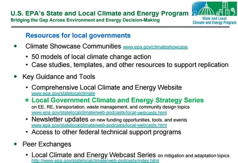
For example, the EPA’s very helpful Local Government Climate and Energy Strategy Series of guides and case studies has been removed from the EPA website along with other climate change information. This information was rescued by the City of Chicago, though at present a technical problem makes the state and local resources inaccessible.

The availability of existing information, and continual acquisition of new data, is uncertain at agencies beyond the EPA. It is of concern to nearly all US agencies whose mission includes scientific research and data sharing. However, cities are committed to working with one another and with international organizations to ensure continued access to the critical climate change data they need.
Lack of Real-Time Open Data
The value of smart city data increasing exponentially when it is made available as open data to all city organizations, city partners (including regional governments) and the public. As smart and connected systems come online they can contribute to a holistic understanding of, and coordination of, city services and their climate impacts, but that data must be freely accessible to do so.
Open smart city data can also be used to develop resident- and business-facing applications that can engage the public in taking action on climate change themselves, from making smarter transportation choices to modifying energy usage to participating in public policy and planning discussions. Many of these types of applications are developed by start-up companies, stimulating economic development while advance climate change goals.
While cities have made much progress in providing open data portals for the public, the availability of real-time smart city data through dashboards and APIs lags behind. There are few solutions from open data portal providers (Opendatasoft is the only open data portal natively designed for real-time sensor data), but other vendors are working to add that capability, as are some open source communities. Many smart city technology vendors also offer open API access to data (though not as many as in Europe), but that data’s full value can still only be realized in a larger open data ecosystem. Hopefully, the options for providing open, multi-source access to open data will expand at a rate that will keep pace with the expanding use of smart city technology.
In spite of the challenges, though, cities in the US have shown that they are deeply committed to upholding the Paris accord on behalf of the nation, and there has been a remarkable flurry of activity to that end since the Trump Administration announced its intention to withdraw. Working with each other at home and abroad, with supportive state governments, with national and international organizations and with the private sector, the prospect of success looks hopeful.
As the GHG reduction case studies here show, cities are already racking us successes in the fight to mitigate climate change. In the next post, “US Mayors Vow to Uphold Paris Climate Accord
Smart City Tech & open data Can Help, Part 2,” we’ll look at examples of successful measures cities have taken to meet climate change adaptation objectives, which make of the other broad category of goals in the Paris Agreement alongside GHG reductions.
Next
As the GHG reduction case studies here show, cities are already racking us successes in the fight to mitigate climate change. In the next post, “Smart City Tech & open data Can Help U.S. Mayors Uphold Paris Climate Accord, Part 3: Adaptation,” we’ll look at examples of successful measures cities have taken to increase resilience in the face of the inevitable impacts of climate change, which makes up the second broad category of goals in the Paris Agreement alongside GHG reductions.


